Decide with evidence
test scenarios before committing budget
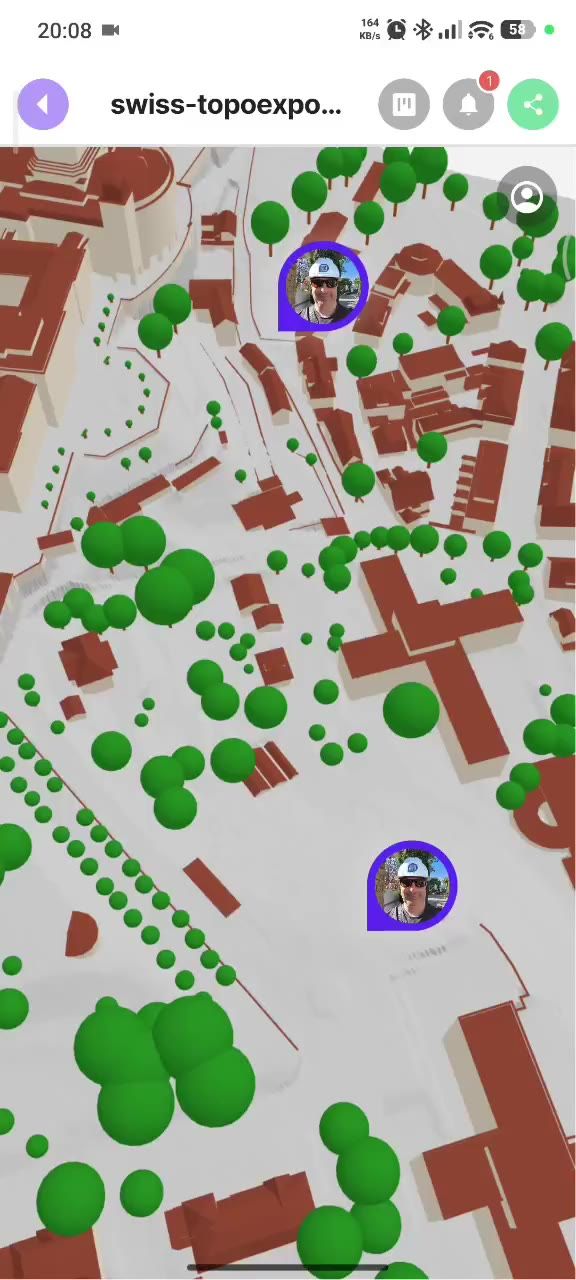
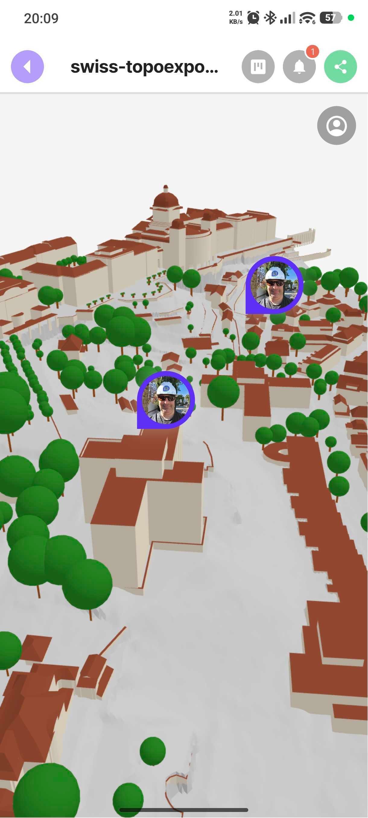
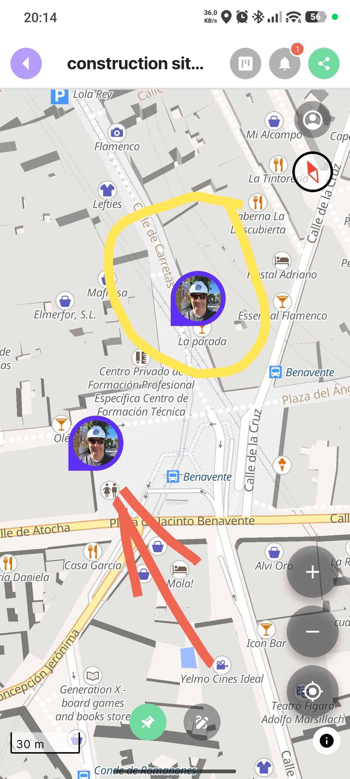
Smart cities don't stall on technology — they stall on communication, and on getting started. Whether you're building a digital twin or just exploring the idea, it begins the same way: with real, current data from the ground — and people who can actually use it. PinMy lets city teams and residents capture what's happening on site — photo, video, voice and text — and pin it onto plans, site photos, maps and 3D/IFC models. The same pin works for a BIM coordinator, a field inspector or a resident. Saule brings the training and community adoption that turn a digital twin from an idea into something used.
A Local Digital Twin is a living digital model of your city — its buildings, streets and infrastructure — kept up to date with real-world data. It lets you see, test and decide before you build or spend: try out a development, check it against the rules, plan for flooding or ageing infrastructure, and bring residents into the process.
test scenarios before committing budget
teams and contractors working from one shared picture
flooding, ageing assets, heritage, disasters
visibility and trust
back proposals with real, current data
A full digital twin can feel far away — expensive, technical, years out. It doesn't have to start that way. The first step is simply capturing what's really happening on the ground, in a structured, visual form. That's PinMy. Begin with one district or one problem; the data you capture is exactly what any twin, BIM or GIS system will need later. You grow into the twin — you don't buy it all at once.
Step 1
Start small
pick one district or one problem
Step 2
Capture the ground-truth
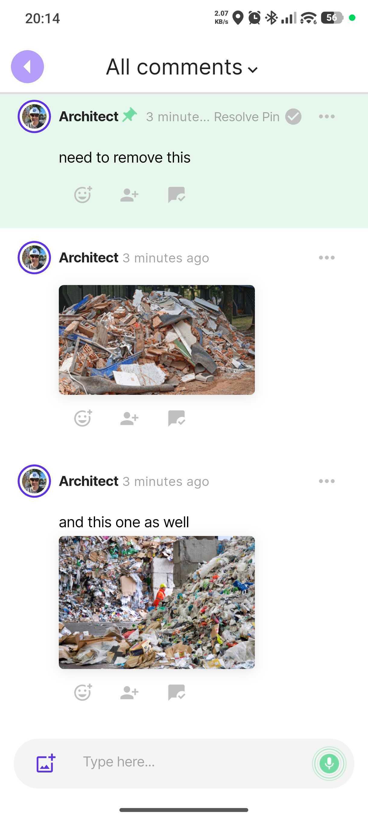
field teams and residents pin photo, video and voice with PinMy, on web or phone — guests need no account or install
Step 3
Feed your model
export the structured, geolocated data into a twin, BIM or GIS platform
Step 4
Grow
add districts, layers and partners as the value proves out — Saule trains your teams and residents along the way
PinMy is the first step — the capture layer. It doesn't model, simulate or run rule-checks; it supplies the real, current data any twin will need.
Local Digital Twin platforms are powerful: they model the built environment in 3D, check designs and detailed plans against the rules — greenery, building distances, heights, protected zones, safety — and run scenarios like sunlight, wind or flooding.
But every one of those checks assumes the model matches reality. Two gaps remain. First, fresh ground-truth — the actual condition of a site today — still arrives slowly, through specialists and manual reporting, so the twin drifts from what's really there. Second, the people who should benefit — municipal field teams, inspectors, residents — are often non-technical and never touch it.
That is the layer PinMy and Saule fill: a simple mobile bridge that captures the real, current state of the ground and brings non-technical people in — so the twin's models and checks run on reality, not assumptions.
Models the designed city and checks it against the rules: zoning, greenery, distances, heights, protected zones, safety; simulates sunlight, wind, flooding.
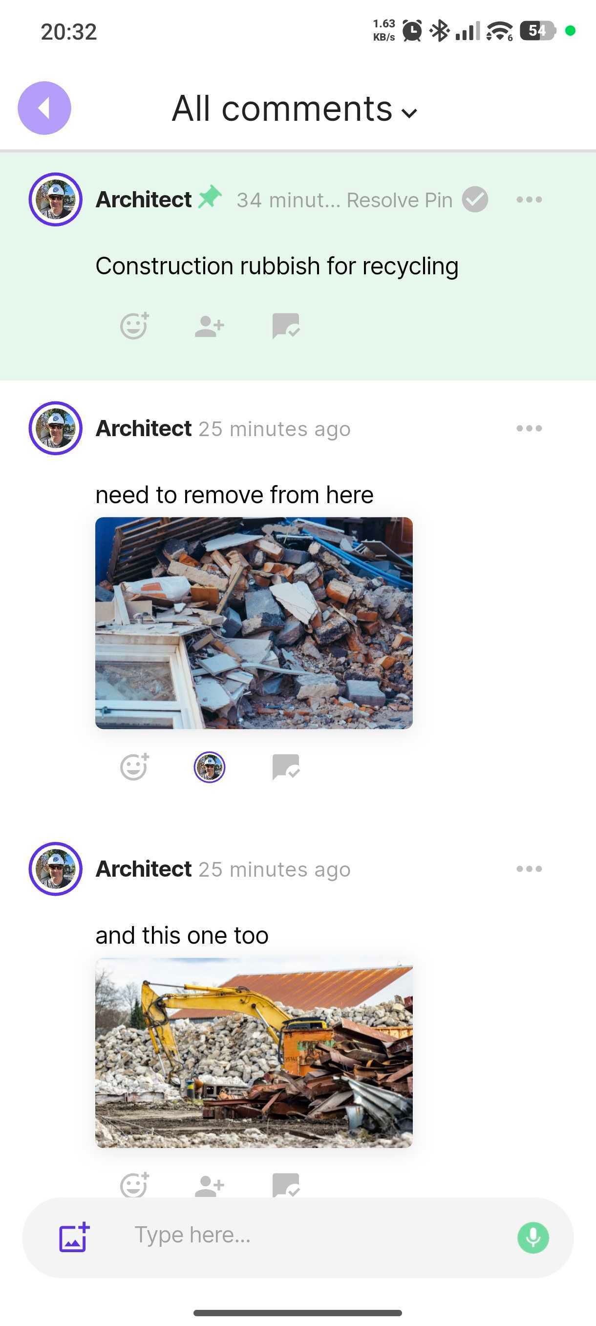
Captures the actual city, today: geolocated photo, video and voice from the field — damage, progress, conditions, citizen input — feeding the twin so its checks reflect reality.
PinMy doesn't analyse — it supplies the ground-truth the analysis depends on.
What's live today
On our roadmap
Saule SIA is a Baltic Sea Region partner (founded 2022) working with municipalities, NGOs, educational institutions and innovation-driven partners. A digital twin only delivers value when the people who depend on it are trained to use it and trust it — that is Saule's role in the consortium.
What Saule brings
How a rollout works
PinMy sits at the very start of the data lifecycle — the moment a real-world observation is made. It captures that input in a structured, geolocated, annotated form, ready to flow into the digital twin platform. The twin does the modelling and analysis; PinMy makes sure it is working with real, current, human-verified input — and that the people on the ground can contribute without friction. PinMy is platform-agnostic: it complements a digital-twin, BIM or GIS stack rather than competing with it.
Step 1
Field & Community
teams · inspectors · residents
Step 2
PinMy capture
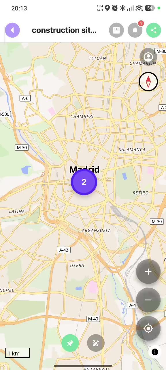
photo · video · voice · text — pinned to plans, photos, maps & 3D/IFC
Step 3
Structured, geolocated data
+ guest links
Step 4
Digital Twin platform
modelling · simulation
Step 5
Planning & decisions
PinMy is the start of the data lifecycle. The twin is where it's analysed.
For a city already running BIM-based planning and automated rule-checks, PinMy adds the field-verification layer: as-built checks, site observations and citizen input pinned onto plans, the city map and IFC models — on any phone. It confirms whether what's on site matches what the twin assumes, and feeds the planning workflow.
Value: field reality is checked against the plan early, before issues become costly.
Where open data is scarce and risk is high — earthquake-affected districts, heritage sites under threat, flood-prone areas — PinMy becomes a rapid ground-truth tool. Field teams document damage, building and heritage-site condition, reconstruction progress and road and infrastructure status with geolocated photo, video and voice pins — building the dataset the twin needs from the ground up. Our team is Ukrainian, so we understand the reconstruction context directly.
Value: a fast, low-cost way to document risk, damage and heritage condition — and the evidence to act and apply for funding.
Not sure where to begin? Start by mapping one concern — flood-prone streets, ageing buildings, a heritage quarter — with geolocated pins anyone can add.
Value: a visible, shareable first result in weeks, not years.
Technology fails in the field when no one is trained to use it or trusts it. Saule's role in the consortium is exactly this: facilitation, education in emerging technologies, and community rollout. PinMy is the tool; Saule makes sure city staff and residents actually adopt it — designing a standardized onboarding process adaptable to each city's use case.
“From purposeful ideas to resilient realities.”
A Baltic Sea Region partner (founded 2022) working with municipalities, NGOs, educational institutions and innovation-driven partners. Saule brings entrepreneurial education, AI literacy and digital-skills training, plus the facilitation and community engagement that turn new technology into real adoption.
| Capability | Status |
|---|---|
| 2D formats (PDF, site photos) | Live |
| Geolocated pins — photo / video / voice / text | Live |
| 3D / IFC model support (auto-converted, mobile) | Live |
| Interactive map across projects | Live |
| Multi-language voice-to-text transcription | Live |
| Freehand sketching on plans | Live |
| OCR on site photos | Live Premium |
| Video annotation | Live Premium |
| Guest access (view & contribute, no account) | Live |
| Data export / portability (no vendor lock-in) | Live |
| Poor-signal site use | Roadmap |
| Two-way issue interoperability with BIM coordination tools | Roadmap |
| GDPR / EU-based data handling | Yes |
BIM, VDC and Digital Twin services on airport, healthcare and large-scale residential projects; part of the PinMy community since 2025.
Strong fit
Secondary (via Saule)
If you have any questions, please contact us in any convenient way.
Fill out the form below: